Tornado Watch Issued for Northeast, 32M Affected
Tornado Watch Issued for Northeast as Storms Hit NYC
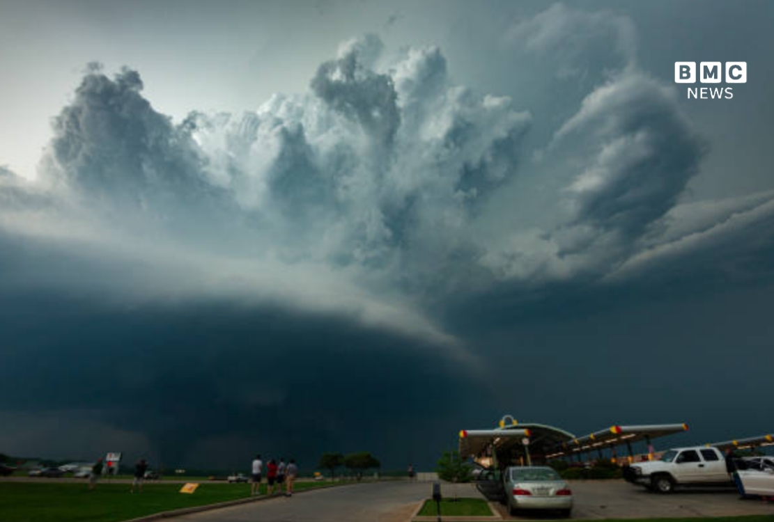
A tornado watch covering tens of millions of residents stretched across the Northeast on Tuesday, as a second and more powerful round of severe storms bore down on the Interstate 95 corridor from Delaware through Philadelphia and New York City into the Catskills. The National Weather Service issued the watch shortly before 2 p.m., warning that atmospheric conditions were favorable for tornadoes to form across parts of Connecticut, Delaware, New Jersey, New York and Pennsylvania through 9 p.m. At least one tornado had already touched down in northeastern Pennsylvania by Tuesday afternoon, and a tornado warning was issued for several New Jersey communities, including Cedar Grove, Caldwell, Morristown, Madison and Florham Park.
How Far the Tornado Watch Stretches
The watch area is unusually broad for the Northeast, covering central and southeastern New York, including the Southern Tier, Catskills, Hudson Valley, the New York City metro area and western Long Island, along with most of New Jersey, eastern and central Pennsylvania, northern Delaware and western Connecticut. Forecasters said the zone contains more than 32.1 million residents, 7,779 schools and 442 hospitals. A separate NWS Albany office extended a tornado watch further north into parts of the Hudson Valley and Mohawk Valley, covering communities including Kingston, Poughkeepsie, Amsterdam and Herkimer.
The National Weather Service said a couple of tornadoes were possible within the watch area, with scattered wind gusts potentially reaching 70 mph and hail as large as ping-pong balls in the strongest storms. A tornado watch means the ingredients for rotating storms — moisture, instability and favorable wind shear — are present, not that a tornado has been confirmed or is imminent.
New York City Braces for a Second Round
All five boroughs, along with Rockland, Westchester and Nassau counties, fell under the watch, which NYC Emergency Management said reflected atmospheric conditions unusually favorable for tornado formation in the city. Meteorologist Nelson Vaz, based at the NWS office in Upton, told reporters the region could see the first tornado touch down on Long Island in four years, even as forecasters put the odds of a tornado forming somewhere in the metro area at roughly 10 percent.
A flash flood watch remained in effect for New York City, Long Island, northern New Jersey and Philadelphia through late Tuesday night, layering a second hazard on top of the tornado risk. Forecasters warned that rainfall rates could hit 2 to 3 inches per hour at their peak, with widespread totals of 1 to 2 inches and isolated pockets of 3 to 4 inches — arriving on ground already saturated from a round of storms that flooded SoHo streets and stranded drivers just days earlier, on July 18.
City and State Officials Urge Caution
New York Mayor Zohran Mamdani posted a direct appeal to residents ahead of the evening’s storms, urging people to move indoors at the first sign of thunder or heavy rain and warning basement-apartment residents in particular to know their exit routes.
The Metropolitan Transportation Authority barred empty tractor-trailers and tandem trucks from crossing its bridges during the evening commute window, citing high-wind risk, while NYC Emergency Management repeated standing guidance for New Yorkers to avoid walking or driving through flooded streets. The advisories echoed similar warnings issued after storms overwhelmed parts of Queens over the weekend, leaving some neighborhoods still recovering when Tuesday’s watch was issued.
Damage and Flooding Reported Beyond New York
The severe weather was not confined to the Northeast corridor. Further west, severe thunderstorm watches stretched from Kentucky to Virginia, covering Charleston, West Virginia, Cincinnati and Pittsburgh. In Iowa, storms Monday night sent flash flooding through Des Moines, stranding nearly two dozen cars on roadways and prompting five water rescues, according to the Des Moines Police Department.
The confirmed tornado in northeastern Pennsylvania and the tornado warning issued for northern New Jersey underscored that Tuesday’s threat had already moved beyond the watch stage in several locations by the afternoon, even as the broader Northeast watch remained precautionary for most of the region through the evening commute.
Part of a Wetter-Than-Normal July
Tuesday’s storms extended what has been an unusually stormy month for the Northeast. New York City has now been placed under a flood watch or tornado watch multiple times in July alone, including after a July 4 heat wave broke with intense rain, a flood watch tied to storms on July 6, and the major rain event on July 18 that turned SoHo streets into rivers. Forecasters have attributed the repeated flooding risk to a combination of high atmospheric moisture and soil that has had little chance to dry out between storm systems.
Emergency officials in multiple states said the immediate priority for residents was distinguishing between a watch and a warning: a tornado watch signals that conditions could support severe rotating storms over a broad area, while a tornado warning means a tornado has actually been detected on radar or spotted on the ground, requiring immediate shelter. Readers can track live radar and the latest advisories through the Storm Prediction Center’s Day 1 Convective Outlook.
Key Facts: Northeast Tornado Watch
- Tornado Watch 507 issued by the National Weather Service at approximately 2:06 p.m. ET Tuesday, July 21, 2026.
- Covers parts of Connecticut, Delaware, New Jersey, New York and Pennsylvania.
- In effect until 9 p.m. ET Tuesday.
- More than 32.1 million people live within the watch area.
- Watch area includes 7,779 schools and 442 hospitals.
- Wind gusts up to 70 mph and hail up to ping-pong-ball size possible.
- A tornado already confirmed in northeastern Pennsylvania Tuesday afternoon.
- Tornado warning issued separately for parts of northern New Jersey.
- Flash flood watch in effect for NYC, Long Island, northern New Jersey and Philadelphia through late Tuesday night.
- Rainfall rates of up to 2 to 3 inches per hour possible in the strongest storms.
Timeline: Tuesday’s Storm Threat
Torrential rain floods SoHo streets and strands drivers, prompting an earlier flood watch and tornado watch for the city.
Weekend storms flood parts of Queens; Des Moines, Iowa sees flash flooding and five water rescues Monday night.
NYC Flood Watch takes effect through 2 a.m. Wednesday as forecasters warn of 1 to 2 inches of rain.
National Weather Service issues Tornado Watch 507 across the Northeast, effective until 9 p.m.
Tornado confirmed in northeastern Pennsylvania; tornado warning issued for parts of northern New Jersey.
Second, stronger storm round reaches the I-95 corridor during rush hour, bringing the greatest risk of damaging winds and isolated tornadoes.
Forecasters said the watch was set to expire at 9 p.m. Tuesday, but cautioned that flash flooding could persist well beyond that, with the citywide flood watch for New York remaining active until 2 a.m. Wednesday. Officials across the region urged residents to keep monitoring local alerts as the storm system continued moving east through the evening.